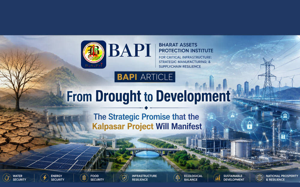
Deep-Water Infrastructure & Ocean-Energy Dynamics | Coastal Security Management | Maritime-Littoral Transformation & Coastal Economy Resilience
|
The Kalpasar Project,
conceptualised across the Gulf of Khambhat in Gujarat, represents one of
India’s most instructive cases in point for the design and strategic planning
of integrated resilience infrastructure where hydrological security, coastal
engineering, transport connectivity, industrial sustainability, agricultural
stabilisation, and climate adaptation converge within a single
infrastructural framework. This study examines the project as a model
initiative from which other Indian states confronting comparable challenges
of hydrological stress, coastal salinity, industrial water demand, and
infrastructure fragmentation may derive transferable strategic principles for
their own developmental planning. The project proposes the construction of an
integrated marine barrier system of approximately 60 km along with a
freshwater reservoir whose capacity has been variously estimated at 7,807
million cubic metres (MCM) in the 2022 pre-feasibility report and May 2026
environmental clearance application, and at nearly 13,000 MCM in broader
policy-level discussions, with estimated project expenditure ranging from
₹1,33,246 crore (May 2026 environmental clearance filing) to approximately
₹1.57 lakh crore (government-linked policy reporting, April 2026). Drawing upon
official government documents, policy assessments, media reporting, and
secondary analytical sources, this study presents the Kalpasar Project as a
model of integrated infrastructure planning while preserving both
interpretations wherever technical specifications have evolved or diverged
across different assessment phases. The study argues that the project’s
deliberate integration of water retention, salinity mitigation, transport
connectivity, industrial water assurance, and climate adaptation within a unified
developmental platform offers a replicable conceptual architecture for future
state-level resilience infrastructure planning across India. |
Keywords : Kalpasar Project; Gulf of Khambhat; integrated resilience infrastructure; hydrological security; marine freshwater reservoir; coastal salinity mitigation; transport connectivity; Indo-Dutch collaboration; critical infrastructure; model project; BAP-I; Gujarat
|
Introduction The Kalpasar Project
represents one of India’s most instructive cases in point for the design and
strategic planning of integrated infrastructure systems where hydrological
security, coastal engineering, transport connectivity, industrial
sustainability, agricultural resilience, and climate adaptation are conceived
not as isolated developmental sectors but as mutually reinforcing dimensions
of a single infrastructural ecosystem. Conceptualised across the Gulf of
Khambhat in Gujarat, the project proposes the construction of an integrated
marine barrier system of approximately 60.13 km, of which nearly 26.7 km lies
within the Gulf itself, along with a freshwater reservoir whose capacity has
been estimated at approximately 7,807 MCM in the 2022 pre-feasibility report
and the May 2026 environmental clearance application (Government of Gujarat, Kalpasar
Department, 2022; DeshGujarat, 2026, May 27), while broader policy-level
discussions and government-linked reporting continue to reference a reservoir
capacity approaching 13,000 MCM (DeshGujarat, 2026, Apr. 4; Deccan Herald,
2026, Apr.). The project seeks to transform western India’s long-term
water-security architecture while simultaneously strengthening regional
development, industrial sustainability, transport connectivity, and climatic
preparedness. It is argued that the
project’s significance extends well beyond Gujarat’s territorial boundaries,
for it increasingly offers a replicable conceptual model from which other
Indian states confronting comparable hydrological vulnerabilities, industrial
water-stress, and coastal infrastructure deficits may study, adapt, and
derive transferable strategic principles for their own developmental
planning. India’s water crisis is structural rather than episodic: the NITI
Aayog’s Composite Water Management Index (2018) observed that nearly 600
million Indians face high to extreme water stress, while national per capita
water availability has declined to approximately 1,100 cubic metres, below
the water-stress threshold of 1,700 cubic metres (NITI Aayog, 2018). Gujarat’s
situation is even more acute, with annual per capita freshwater availability standing
near 920 cubic metres (DeshGujarat, 2026, Apr. 4). The Kalpasar framework, by
seeking to intercept the estimated 30,000 MCM of freshwater presently
draining without capture into the Arabian Sea annually through river systems
entering the Gulf of Khambhat, responds to this structural vulnerability at a
scale and with an integrative ambition that positions it as a model for
state-level resilience planning across the country. What makes the Kalpasar
initiative particularly instructive as a model study is its deliberate
integration of functions that conventional infrastructure planning has
historically treated as separate and unrelated domains. The project
simultaneously addresses freshwater retention, salinity mitigation,
groundwater stabilisation, agricultural irrigation, industrial water
assurance, freight mobility, regional logistics integration, and
long-duration climate adaptation within a unified developmental framework. It
is suggested that states with semi-arid climatic conditions, coastal salinity
challenges, river systems discharging unharnessed freshwater into the sea,
and expanding industrial water demand may find in the Kalpasar architecture a
case in point for the design of integrated resilience infrastructure at the
regional scale. The project’s evolution across nearly four decades of
conceptualisation, feasibility assessment, engineering revision, and
international technical collaboration, now anchored by the India-Netherlands
Strategic Partnership on Water established in 2022 and the Letter of Intent
signed in May 2026 (Ministry of External Affairs, 2026, May; Netherlands
Embassy in India, n.d.), also offers valuable institutional and procedural
lessons on the governance of long-duration infrastructure planning within
complex marine environments. The Dutch Afsluitdijk,
a 32 km closure dyke completed in 1932 that transformed the saline Zuiderzee
inlet of the North Sea into the freshwater IJsselmeer lake of approximately
1,100 square kilometres, stands as the closest international analogue to the
Kalpasar concept (Britannica, n.d., Afsluitdijk). The parallels between the
two projects, wherein a marine barrier converts a saline water body into a
controlled freshwater reservoir supporting agriculture, industry, and
regional development, have been formally acknowledged through the Indo-Dutch
technical cooperation framework. It is argued that this international
dimension of the project, and the institutional willingness to engage global
expertise for a challenge of this complexity, constitutes itself a
transferable model lesson for other states. This study is presented
under the publication framework of the Bharat Assets Protection Institute
(BAP-I), for the Kalpasar Project’s multi-dimensional character as an
integrated system combining hydrological retention, transport connectivity,
industrial water assurance, coastal engineering, renewable energy, and
climate adaptation positions it squarely within the domain of critical
infrastructure studies. A project whose failure, disruption, or
non-completion would carry consequences extending simultaneously across water
security, agricultural productivity, industrial continuity, transport
mobility, and regional economic stability represents precisely the category
of nationally significant infrastructure asset whose design, governance, and
long-duration sustainability BAP-I seeks to advance through its research and
publication activities. Hydrological
Security and Water Resilience The strategic relevance
of the Kalpasar Project emerges from the structural realities of Gujarat’s
growing hydrological stress despite rapid industrialisation, urbanisation, expanding
manufacturing ecosystems, and rising long-term freshwater demand across
domestic, agricultural, industrial, and coastal economic sectors. Recent
policy assessments indicate that Gujarat’s annual per capita freshwater
availability presently stands near 920 cubic metres against an indicative
adequacy benchmark of approximately 1,700 cubic metres, signalling the
possibility of severe future water stress if large-scale and long-duration
storage infrastructure is not developed (DeshGujarat, 2026, Apr. 4). By way
of national context, the NITI Aayog’s Composite Water Management Index (2018)
noted that India’s overall per capita water availability had declined to
approximately 1,100 cubic metres, placing the country below the water-stress
threshold, and observed that nearly 600 million Indians face high to extreme
water stress (NITI Aayog, 2018). Gujarat’s figure of 920 cubic metres
therefore represents an even more acute expression of a national structural
vulnerability. Simultaneously, government-linked studies estimate that nearly
30,000 MCM of freshwater from multiple river systems presently drains without
capture into the Arabian Sea every year, particularly through rivers
discharging into the Gulf of Khambhat (DeshGujarat, 2026, Apr. 4). It is
argued that this hydrological arithmetic, wherein demand approaches dangerous
thresholds while supply drains away seasonally without retention, constitutes
precisely the category of structural vulnerability that other Indian states
experiencing comparable patterns of river-discharge loss and rising demand
may study with a desire to identify analogous intervention opportunities
within their own regional contexts. The Kalpasar framework
seeks to intercept, regulate, and preserve a substantial portion of this
hydrological outflow through a controlled marine freshwater reservoir system
designed to support drinking water supply, irrigation expansion, industrial
water assurance, salinity mitigation, and regional hydrological stabilisation
across western Gujarat. The project envisages the creation of a large
freshwater reservoir within the Gulf of Khambhat through the construction of
a marine barrier system connecting the Bhavnagar region with the
Bharuch-Dahej corridor. The technical specifications associated with the
project have, it should be noted, evolved significantly over time across
different feasibility phases, engineering revisions, and policy discussions.
Earlier conceptual configurations discussed a marine barrier extending
approximately 64 km across the Gulf along with gross storage estimates
exceeding 16,000 MCM. Subsequent engineering revisions reduced the principal
sea-dam segment to nearly 30 km, with several official technical assessments
referring to live-storage capacities near 7,800–8,000 MCM primarily linked to
the Narmada, Mahi, Sabarmati, and Dhadhar river systems. More recent
policy-level discussions and infrastructure narratives continue to refer to
the broader Kalpasar alignment as an approximately 60 km integrated marine
infrastructure corridor associated with a freshwater reservoir capacity of
nearly 13,000 MCM and a reservoir spread area approaching 1,800 square
kilometres (Government of Gujarat, n.d.; DeshGujarat, 2026, Apr. 4). The May
2026 environmental clearance application filed with the Ministry of
Environment, Forest and Climate Change specified a reservoir capacity of
7,807 MCM and an updated project cost of ₹1,33,246 crore (DeshGujarat, 2026,
May 27), whereas earlier government-linked policy reporting had referenced an
estimated project expenditure of approximately ₹1.57 lakh crore (DeshGujarat,
2026, Apr. 4). These variations reflect the project’s evolving technical
configurations, changing hydrological assumptions, phased design
modifications, and ongoing reassessment of engineering feasibility within a
highly dynamic marine environment. This study preserves both sets of figures
rather than adjudicating between them, noting that each emerges from a
distinct assessment context and reporting framework. The model significance
of this evolving technical trajectory is itself instructive. States
contemplating large-scale hydrological interventions may observe that
sustained feasibility assessment, iterative engineering recalibration, and
the willingness to revise initial configurations in response to emerging
hydrodynamic, environmental, and institutional evidence constitute essential
features of responsible infrastructure planning within complex natural
environments. The Kalpasar experience demonstrates that the pathway from
conceptualisation to execution in marine hydrological systems is not linear
but iterative, and that engineering honesty in revising ambitious initial
proposals strengthens rather than weakens a project’s long-term viability. The hydrological
architecture of the project integrates inflows from multiple rivers entering
the Gulf of Khambhat, including the Narmada, Sabarmati, Mahi, Dhadhar,
Wadhvan Bhogavo, Limbadi Bhogavo, Sukhbhadar, Utavali, Keri, Ghelo, and Kalubhar
river systems (DeshGujarat, 2026, Apr. 4). It should be noted that the
revised L3 alignment shifts the dyke approximately 15 km north of the Narmada
estuary, keeping the Narmada’s direct discharge outside the proposed
reservoir; Narmada water would instead enter the system through a diversion
canal linked to the Bhadbhut Barrage, presently under construction on the
Narmada River with approximately 53 per cent physical completion as of March
2025 and full operational readiness projected by July 2027 (ANI, 2025, Mar.
29; Government of Gujarat, Kalpasar Department, n.d., Bhadbhut). The broader
objective remains the preservation of freshwater before marine discharge with
a desire to establish a long-duration hydrological reserve capable of
supporting drinking water distribution, irrigation networks, industrial
supply systems, groundwater stabilisation, and coastal salinity-control
mechanisms. From a hydro-geological
perspective, the project also seeks to mitigate seawater intrusion into
coastal aquifers, a persistent challenge affecting groundwater quality,
agricultural productivity, and rural settlements across western coastal
districts. By creating a controlled freshwater retention zone within the Gulf
of Khambhat, the project aims to reduce salinity ingress pressures while
strengthening long-term regional water resilience. In this context, the
Kalpasar Project increasingly represents not merely a conventional storage
dam but a complex marine hydrological retention and coastal freshwater
management system integrating river interception, salinity regulation,
regional water redistribution, and strategic resilience infrastructure within
a unified developmental framework. It is suggested that the project’s
approach to combining upstream interception with downstream salinity
mitigation offers a particularly impactable model for other coastal states
where groundwater degradation from seawater intrusion has historically
constrained agricultural productivity and rural settlement viability. Engineering and
Infrastructure Architecture Technically, the
Kalpasar Project envisages the construction of a large marine barrier system
across the Gulf of Khambhat connecting the Bhavnagar region in Saurashtra
with the Bharuch-Dahej industrial corridor in South Gujarat. Similar to the
project’s hydrological specifications, the engineering configuration of the
sea barrier has evolved across different conceptual, feasibility, and revised
planning stages. Earlier project proposals discussed a continuous marine
barrier extending nearly 64 km across the Gulf of Khambhat, positioning it
among the world’s largest sea-dam concepts within a tidal marine environment.
Subsequent engineering reassessments and hydrodynamic studies later revised
the principal sea-dam segment to approximately 30 km, with the 2022
pre-feasibility report identifying approximately 26.7 km of direct marine
barrier construction as part of the revised core structure (Government of
Gujarat, Kalpasar Department, 2022; DeshGujarat, 2026, May 27). The May 2026
environmental clearance application confirmed the 60.13 km dyke alignment
connecting Kardej village in Bhavnagar district to Paniyadra village in
Bharuch district, with a 130 metre transport corridor, a 16-lane roadway, and
a four-lane railway line (DeshGujarat, 2026, May 27). Despite these revised
engineering dimensions, contemporary infrastructure and policy discussions
continue to describe the broader Kalpasar framework as an approximately 60 km
integrated marine infrastructure corridor owing to the inclusion of
associated embankments, transport alignments, approach systems, and
connectivity infrastructure linked with the larger Gulf-crossing
architecture. The proposed marine
barrier system has been conceptualised not merely as a conventional dam
structure but as a multi-functional infrastructure platform integrating
hydrological retention, transport connectivity, coastal engineering, and
regional logistics integration. The May 2026 environmental clearance
application also referenced a wind-solar hybrid system capable of generating
approximately 2,500 million units of renewable energy annually (DeshGujarat,
2026, May 27), indicating that the project’s multi-purpose character extends
to energy generation alongside water retention, transport, and salinity
control. It is argued that this integration of transport, energy, and
hydrological functions within a single marine infrastructure platform offers
a model of particular relevance for other states seeking to maximise the
developmental returns of large-scale coastal engineering investments by
embedding multiple functional capacities within unified structural designs. The engineering
complexity of the project is significantly amplified by the unique
hydrodynamic conditions of the Gulf of Khambhat, which possesses one of the
highest tidal variations in India along with intense sedimentation behaviour,
strong tidal currents, shifting coastal geomorphology, and complex
saline-water interactions. Technical assessments have identified that the
rivers feeding into the Gulf carry substantial sediment loads, making
sedimentation management a critical dimension of the project’s long-term
engineering strategy (Government of Gujarat, Kalpasar Department, 2022). The
project requires extensive marine engineering, hydrodynamic modelling,
sediment-control analysis, and coastal stabilisation mechanisms before
large-scale execution can be undertaken. The construction site also
intersects the Cambay fault line and the Narmada-Sone geo-fracture zone,
adding seismic considerations to the project’s already formidable engineering
profile (Government of Gujarat, Kalpasar Department, 2022). These engineering
complexities have necessitated a comprehensive and multi-phase feasibility
assessment process, and the government’s engagement of approximately 20
national and international organisations in the project’s technical studies
reflects the seriousness with which these challenges are being addressed. The freshwater
reservoir associated with the project is projected in recent planning
discussions to spread across nearly 1,800 square kilometres, positioning it
among the world’s largest freshwater reservoirs proposed within a marine
coastal environment. By comparison, the Dutch IJsselmeer, created by the
Afsluitdijk in 1932, covers approximately 1,100 square kilometres
(Britannica, n.d., IJsselmeer). Reservoir-area projections and storage
calculations have also varied across different technical assessments
depending on dam alignment, Full Reservoir Level (FRL), tidal modelling
assumptions, sedimentation estimates, and revised hydrological inflow calculations.
Earlier conceptual studies discussed substantially larger gross-storage
capacities and marine spread zones, while revised engineering models sought
more technically manageable configurations balancing hydrological utility
with environmental feasibility. In addition to water
retention and transport integration, earlier technical planning documents
also explored tidal-energy generation possibilities associated with the
Gulf’s powerful tidal movements. Although the tidal power component was later
dropped from the main proposal (Government of Gujarat, n.d.), the May 2026
application substituted wind-solar hybrid energy, reflecting the project’s
continuing evolution toward multi-purpose infrastructure integration. From a
strategic infrastructure perspective, the Kalpasar Project increasingly moves
beyond the category of conventional irrigation engineering and enters the
domain of civilisational-scale coastal infrastructure combining marine
engineering, hydrological retention, logistics connectivity, industrial
integration, transport mobility, renewable energy, and regional resilience
architecture within a unified developmental framework. It is suggested that
states interrogating the question of how to extract maximum developmental
value from large-scale infrastructure investments may find in the Kalpasar
architecture a transferable design philosophy centred on functional
integration rather than sectoral isolation. Agricultural and
Industrial Transformation From an agricultural
perspective, the Kalpasar Project carries potentially transformative
implications for the drought-prone and water-stressed landscapes of
Saurashtra, Kutch, and adjoining regions of western Gujarat. The broader
developmental rationale of the project has consistently centred on the
stabilisation of agriculture in semi-arid zones historically characterised by
erratic rainfall patterns, groundwater depletion, salinity ingress, and
recurrent hydrological vulnerability. Earlier technical and planning
assessments associated with the project projected irrigation potential
exceeding ten lakh hectares through integrated canal distribution systems,
pumping infrastructure, and regional freshwater redistribution mechanisms (Dholera
Prime, 2020, Dec.). The official Kalpasar website describes the project as
intended to provide irrigation benefits to approximately 9.99 lakh hectares
across 42 talukas in nine districts of Saurashtra (Government of Gujarat,
n.d.). Irrigation projections have varied across different feasibility phases
depending on reservoir-storage assumptions, revised hydrological
calculations, and engineering modifications associated with the changing
project configuration. What is instructive for
other Indian states confronting comparable agro-climatic vulnerabilities is
the manner in which the Kalpasar framework conceptualises agricultural
stabilisation not as a standalone irrigation objective but as an embedded
function within a broader infrastructure ecosystem. By facilitating
freshwater retention within a drought-prone coastal ecosystem, the project
seeks to strengthen long-duration agricultural resilience through enhanced
crop stability, improved irrigation reliability, salinity mitigation, and
reduced dependence on overexploited groundwater systems. It is argued that
such interventions could substantially improve agro-industrial productivity,
rural water security, livestock sustainability, and food-system resilience
across semi-arid regions vulnerable to climatic uncertainty and declining
groundwater quality. The NITI Aayog has noted that approximately 87 per cent
of annual groundwater extraction in India serves agricultural activities
(NITI Aayog, 2018), making the preservation of alternative surface-water
sources a matter of strategic national significance. States with
drought-prone agricultural hinterlands may therefore study the Kalpasar
approach as a model for embedding agricultural water security within larger
infrastructure investments rather than treating irrigation as a separate and
self-contained developmental exercise. A major hydrological
objective associated with the project involves the mitigation of seawater
intrusion into coastal aquifers, particularly across salinity-affected
agricultural zones of Saurashtra and coastal Gujarat. Salinity ingress has
historically reduced soil fertility, constrained groundwater usability, and
weakened agricultural productivity in several coastal districts. The Bhadbhut
Barrage on the Narmada River, an associated precursor project presently under
construction, is specifically designed to prevent tidal salinity ingress up
to 70 kilometres upstream at Shuklatirth while creating a freshwater
reservoir of approximately 599 MCM for drinking and industrial water supply
(Government of Gujarat, Kalpasar Department, n.d., Bhadbhut; DeshGujarat,
2025, Mar. 29). The Bhadbhut Barrage therefore functions as both an
independent salinity-mitigation intervention and a critical component of the
broader Kalpasar hydrological framework. The industrial and
economic dimensions of the project are equally significant. Gujarat hosts
some of India’s most strategically important industrial ecosystems, including
petrochemical complexes, refinery networks, port-led industrial corridors,
logistics infrastructure, Special Economic Zones (SEZs), coastal
manufacturing clusters, and the Dholera Special Investment Region (DSIR). The
Kalpasar Project therefore assumes strategic importance as a potential
industrial water-security platform capable of supporting manufacturing
continuity, industrial resilience, logistics ecosystems, and future economic
expansion across western India’s coastal industrial corridor architecture. At the same time, the
project’s agricultural-industrial interface remains technically and
politically sensitive because the allocation of stored freshwater across
irrigation, urban consumption, industrial usage, and ecological requirements
will require carefully balanced governance mechanisms. It is suggested that
future operational frameworks may need to address competing sectoral
priorities involving agriculture, industry, groundwater sustainability,
ecological preservation, and rural livelihoods within a highly
water-constrained environment. This governance dimension of the project is,
it is argued, particularly impactable as a model lesson for other states, for
the technical success of integrated infrastructure systems ultimately depends
upon the institutional capacity to manage competing demands across sectors
with fundamentally different time-horizons, political constituencies, and
developmental logics. Transport
Connectivity and Logistics Integration The transport dimension
of the Kalpasar Project substantially amplifies its strategic and economic
significance beyond the conventional framework of water-resource
infrastructure. From its earlier conceptual stages, the project was
envisioned not merely as a marine freshwater retention system but also as a
major coastal transport corridor capable of physically integrating the
Saurashtra region with South Gujarat through direct roadway and railway
connectivity across the Gulf of Khambhat. The May 2026 environmental
clearance application described a 130 metre corridor carrying a 16-lane
roadway and a four-lane railway line, reducing the travel distance between
Bhavnagar and South Gujarat from approximately 240 km to approximately 60 km
across the Gulf (Government of Gujarat, n.d.; DeshGujarat, 2026, May 27). It
is argued that the principle of embedding transport infrastructure within
hydrological engineering structures, rather than constructing separate road
and water systems in parallel, offers a model of resource-efficient
infrastructure design that other states managing simultaneous water-deficit
and connectivity-deficit challenges may find strategically instructive. The logistics
implications of such a corridor are particularly significant within the
context of Gujarat’s coastal industrial ecosystem. Gujarat hosts some of
India’s most important port infrastructure networks, industrial clusters,
petrochemical corridors, Special Economic Zones (SEZs), logistics hubs, and
export-oriented manufacturing ecosystems. Improved cross-gulf connectivity
could therefore facilitate more efficient movement of industrial goods, raw
materials, container traffic, agricultural commodities, and workforce
mobility between Saurashtra, central Gujarat, and the southern industrial
belt. In strategic terms, the project may contribute to supply-chain
resilience, freight-network optimisation, multimodal transport integration,
and coastal economic consolidation linked with maritime trade ecosystems and
industrial logistics architecture. From a national
infrastructure perspective, the project aligns with India’s broader
priorities relating to logistics modernisation, multimodal freight mobility,
industrial competitiveness, transport efficiency, and strategic coastal
connectivity. The strategic value of the project is further amplified by its
potential contribution to regional resilience during climatic disruptions,
supply-chain interruptions, or transport bottlenecks affecting existing
inland routes. By creating an alternative cross-gulf connectivity platform,
the project may strengthen redundancy within Gujarat’s transport and
logistics architecture while supporting continuity across industrial and
freight ecosystems concentrated along western India’s coastal belt. It is
suggested that other states contemplating large-scale coastal or riverine
infrastructure investments may study the Kalpasar approach as a transferable
model for maximising multi-sectoral returns from unified infrastructure
platforms. Climate
Adaptation and Strategic Resilience The Kalpasar Project
increasingly acquires significance within India’s evolving climate-security
environment where hydrological stress, coastal urbanisation, industrial
expansion, groundwater depletion, ecological vulnerability, and
infrastructure continuity are becoming deeply interconnected. While the
project was initially conceptualised primarily as a large-scale freshwater
conservation and irrigation initiative, contemporary policy discussions
increasingly position it within the broader framework of climate adaptation,
long-duration water resilience, and integrated regional sustainability
planning. In this context, the project demonstrates how large-scale
hydrological infrastructure may potentially function simultaneously as a
drought mitigation mechanism, coastal freshwater retention system,
salinity-control framework, transport corridor, and regional resilience
platform within climate-vulnerable coastal environments. It is argued that
this multi-functional climate adaptation character of the project constitutes
one of its most instructive dimensions for other states, for it illustrates
how infrastructure designed for one primary purpose may be architecturally
expanded to serve climate-resilience objectives without requiring entirely
separate institutional or engineering frameworks. The strategic logic
underlying the project is closely linked with the increasing frequency of
climatic variability affecting western India, including irregular monsoon
behaviour, prolonged dry periods, groundwater stress, rising freshwater
demand, coastal salinity intrusion, and expanding competition among
agricultural, industrial, and urban water requirements. Semi-arid regions of
Gujarat, particularly Saurashtra and Kutch, have historically experienced
recurrent hydrological instability characterised by rainfall variability,
declining groundwater tables, and periodic drought conditions. The Kalpasar
framework seeks to partially address these vulnerabilities by preserving
freshwater presently discharging into the Arabian Sea and converting seasonal
hydrological surplus into long-duration regional storage capacity capable of
supporting water continuity during future stress conditions. At the national level,
the Kalpasar framework increasingly offers a conceptual model for future
large-scale infrastructure planning in India where water management,
logistics systems, transport connectivity, industrial sustainability, and
climate adaptation are treated as interconnected strategic domains rather
than isolated developmental sectors. It is suggested that states across
India’s eastern, western, and southern coastlines, many of which confront
analogous combinations of hydrological stress, industrial water demand, and
climate vulnerability, may find in the Kalpasar architecture a transferable
planning philosophy centred on converting sectoral vulnerabilities into
integrated resilience opportunities. At the same time, the project’s climate
adaptation potential is closely linked with ongoing environmental and engineering
assessments involving sedimentation dynamics, tidal regulation, marine
ecology, fisheries management, coastal geomorphology, evaporation losses, and
long-term ecological sustainability within the Gulf of Khambhat, assessments
that the government is pursuing with the rigour that a project of this
national significance demands. Engineering
Complexity and International Collaboration Despite its
transformative developmental promise, the Kalpasar Project remains one of the
most technically, environmentally, and hydrodynamically complex
infrastructure initiatives ever proposed in India. The Gulf of Khambhat
possesses exceptionally high tidal range and strong tidal currents, which are
among the most intense within India’s coastal environment. These conditions
create significant technical complications involving sediment deposition,
erosion dynamics, saline intrusion, structural stability, reservoir
management, and tidal-flow regulation. It is argued that the transparency
with which Gujarat has engaged these engineering uncertainties, rather than
suppressing or minimising them, constitutes a model of institutional honesty
that other states contemplating complex infrastructure interventions may
study with profit. Over the years,
multiple technical studies and feasibility assessments have been initiated to
evaluate the project’s environmental and engineering sustainability. Recent
reports indicate that approximately 51 technical and environmental studies
associated with the project have already been completed, while three
additional studies remain under progress with projected completion by June
2028 (DeshGujarat, 2026, Apr. 4). Approximately 20 national and international
organisations have been involved in these studies (DeshGujarat, 2026, Apr.
4). On 21 May 2026, the Kalpasar Department submitted a fresh application to
the Ministry of Environment, Forest and Climate Change seeking approval to
conduct a detailed Environmental Impact Assessment (EIA) study, with CSIR-National
Environmental Engineering Research Institute engaged as the accredited
consultant (DeshGujarat, 2026, May 27). If required clearances are granted on
schedule, construction could commence in May 2028 and be completed by late
2035 (DeshGujarat, 2026, May 27). The Gujarat government informed the state
assembly in February 2026 that the Detailed Project Report was in its
finalisation stage as of 31 December 2025, and that the project was expected
to take eight years from commencement to completion (DeshGujarat, 2026, Apr.
4). The financial scale of
the project has correspondingly increased with successive technical revisions
and infrastructure expansion proposals. The 2022 pre-feasibility report
placed the estimated project cost at ₹1,00,200 crore (Government of Gujarat,
Kalpasar Department, 2022). Government-linked policy reporting in April 2026
referenced an estimated expenditure of approximately ₹1.57 lakh crore
(DeshGujarat, 2026, Apr. 4). The May 2026 environmental clearance application
revised the project estimate to ₹1,33,246 crore (DeshGujarat, 2026, May 27).
This study notes both figures without adjudicating between them, as the
discrepancy may reflect different scope assumptions, component inclusions, or
reporting conventions at different points in the project’s evolving
assessment trajectory. Environmental
considerations remain an integral component of the project’s comprehensive
planning framework. Potential ecological dimensions involving fisheries
management, marine biodiversity, sediment redistribution, coastal ecosystem
dynamics, saline-water behaviour, and estuarine ecological balance are being
systematically examined through the 51 completed and three ongoing technical
studies. The Government of Gujarat’s decision on 21 May 2026 to engage
CSIR-National Environmental Engineering Research Institute as the accredited
consultant for a detailed Environmental Impact Assessment (DeshGujarat, 2026,
May 27) reflects the institutional commitment to ensuring that environmental
assessment and engineering feasibility proceed as parallel and mutually
conditioning processes. It is suggested that this approach offers a lesson of
considerable transferable significance for other states proposing large-scale
interventions within ecologically sensitive environments, demonstrating that
responsible infrastructure planning treats environmental sustainability not
as a regulatory obstacle but as an integral design parameter. Recent Indo-Dutch
collaboration discussions have further elevated the project’s international
technical dimension. On 17 May 2026, India and the Netherlands signed a
Letter of Intent between the Ministry of Jal Shakti and the Netherlands’
Ministry of Infrastructure and Water Management for technical cooperation on
the Kalpasar Project, during Prime Minister Narendra Modi’s visit to the
Netherlands where he inspected the Afsluitdijk alongside Dutch Prime Minister
Rob Jetten (Ministry of External Affairs, 2026, May; Deccan Herald, 2026,
Apr.). The two countries simultaneously elevated their bilateral relationship
to a full Strategic Partnership, signing 17 major agreements spanning semiconductors,
green hydrogen, defence, critical minerals, and water cooperation (ChannelIAM,
2026, May 18). Both leaders welcomed the establishment of a Centre of
Excellence on Water under the Ministry of Jal Shakti in collaboration with
the Netherlands’ Ministry of Infrastructure and Water Management at IIT Delhi
(Ministry of External Affairs, 2026, May). The Netherlands possesses globally
recognised expertise in sea barriers, reclaimed-land systems, delta engineering,
tidal management, and coastal resilience architecture developed through
centuries of experience in managing low-lying marine environments.
Institutions such as Royal HaskoningDHV have already contributed to
Kalpasar’s technical planning (Open Magazine, 2026, May 18). This cooperation
builds upon the India-Netherlands Strategic Partnership on Water launched in
2022 (Netherlands Embassy in India, n.d.). It is argued that the
willingness to seek international technical partnerships for a project of
this complexity, rather than relying exclusively on domestic engineering
capacities, constitutes a model of institutional pragmatism that other states
may study as a precedent for engaging global expertise in the service of
national developmental objectives. The Indo-Dutch engagement signifies a
broader transition in how large-scale infrastructure projects are
increasingly conceptualised within the context of climate adaptation and
coastal resilience planning, and it aligns with the broader cooperative
framework articulated through the Coalition for Disaster Resilient
Infrastructure (CDRI), of which both India and the Netherlands are members
(Netherlands Embassy in India, n.d.). Major Takeaways It is argued that the
Kalpasar Project increasingly reflects a multi-dimensional resilience
architecture integrating hydrological security, coastal engineering,
transport connectivity, industrial sustainability, agricultural
stabilisation, and long-term climate adaptation within a single
infrastructural framework, moving well beyond the identity of a conventional
dam project. What makes this integration instructive as a model for other
states is the deliberate architectural convergence of functions that
conventional infrastructure planning has historically addressed through
separate and disconnected interventions. The project emerges
from Gujarat’s growing freshwater vulnerability despite rapid
industrialisation and urbanisation, set within a national context wherein
NITI Aayog has observed that nearly 600 million Indians face high to extreme
water stress (NITI Aayog, 2018). Gujarat’s annual per capita freshwater
availability of approximately 920 cubic metres (DeshGujarat, 2026, Apr. 4)
sits well below both the national average of approximately 1,100 cubic metres
and the adequacy benchmark of 1,700 cubic metres. Government-linked
assessments indicate that nearly 30,000 MCM of freshwater presently drains
without capture into the Arabian Sea annually (DeshGujarat, 2026, Apr. 4).
States experiencing comparable patterns of seasonal hydrological surplus
draining into the sea while freshwater demand grows inland may study this
interception-and-retention model as a transferable strategic principle. The project’s
engineering configuration has evolved considerably across different
feasibility and planning stages. Earlier conceptual proposals discussed a
nearly 64 km marine barrier with gross storage estimates exceeding 16,000
MCM. The 2022 pre-feasibility report and the May 2026 environmental clearance
application describe a 60.13 km dyke with a reservoir capacity of
approximately 7,807 MCM and estimated costs of ₹1,00,200 crore and ₹1,33,246
crore respectively (Government of Gujarat, Kalpasar Department, 2022;
DeshGujarat, 2026, May 27). Broader policy-level discussions reference a
reservoir capacity approaching 13,000 MCM with estimated expenditure near
₹1.57 lakh crore (DeshGujarat, 2026, Apr. 4; Deccan Herald, 2026, Apr.). This
study preserves both sets of figures, noting that each emerges from a
distinct assessment context. The project integrates
inflows from multiple river systems entering the Gulf of Khambhat and
incorporates a major transport system comprising a 16-lane roadway and
four-lane railway over a 130 metre corridor (Government of Gujarat, n.d.;
DeshGujarat, 2026, May 27). The May 2026 application also includes a
wind-solar hybrid energy system capable of generating 2,500 million units
annually (DeshGujarat, 2026, May 27). The project intersects with Gujarat’s
major industrial ecosystems and functions within the framework of climate
adaptation and regional resilience planning. Approximately 51 technical and
environmental studies have been completed, with three ongoing until June 2028
(DeshGujarat, 2026, Apr. 4). The Indo-Dutch Letter of Intent signed on 17 May
2026 has elevated the project’s international technical significance
(Ministry of External Affairs, 2026, May). It is argued that the
Kalpasar Project increasingly represents a new category of integrated
national resilience infrastructure where hydrological engineering, transport
systems, industrial continuity, logistics mobility, renewable energy, climate
adaptation, and coastal sustainability converge within a unified
developmental ecosystem. Other states may study this model with a desire to
adapt its integrative principles to their own regional developmental
contexts. Conclusion The Kalpasar Project
increasingly represents more than a conventional water-storage programme. It
reflects the emergence of integrated national resilience infrastructure where
hydrological security, industrial continuity, logistics connectivity, climate
adaptation, agricultural sustainability, renewable energy, and strategic
coastal development converge within a single infrastructural framework. In an
era marked by climate uncertainty, water stress, industrial expansion, and
supply-chain vulnerability, the project illustrates how future infrastructure
systems may evolve from isolated sectoral interventions into multi-layered
resilience ecosystems capable of shaping long-term developmental stability
and strategic national transformation. It is argued that the
Kalpasar Project’s significance as a model study extends across three
distinct but interconnected dimensions. By one end, the project demonstrates
the technical and institutional architecture required for integrated marine
infrastructure planning within dynamic coastal environments, offering
transferable design principles for states contemplating comparable
hydrological interventions. On the other hand, the project’s iterative
feasibility trajectory, spanning nearly four decades of engineering
reassessment, environmental study, and international collaboration now
formalised through the India-Netherlands Strategic Partnership, offers a
procedural model for the governance of complex, long-duration infrastructure
initiatives where engineering ambition must be continuously reconciled with
hydrodynamic reality, environmental sustainability, and evolving climatic
conditions. And at a broader level, the project illustrates how the
deliberate integration of water security, transport connectivity, industrial
enablement, agricultural stabilisation, renewable energy, and climate
adaptation within a unified infrastructure platform may create a category of
developmental intervention whose strategic value exceeds the sum of its
individual sectoral contributions. It is suggested that
other Indian states, particularly those confronting comparable challenges of
hydrological stress, coastal salinity, industrial water demand, and
infrastructure fragmentation, may study the Kalpasar framework not merely as
a project to be replicated in its specific engineering form but as a
conceptual model for the design of integrated resilience infrastructure
adapted to their own regional conditions, developmental priorities, and
institutional capacities. The publication of this study under the auspices of
the Bharat Assets Protection Institute (BAP-I) reflects the conviction that
the Kalpasar Project’s multi-dimensional character positions it within the
domain of critical infrastructure studies, and that its documentation as a
model-project initiative contributes to India’s growing body of scholarship
on the design, governance, and protection of nationally significant
infrastructure systems upon which long-term economic security and
developmental resilience depend.
|